
A site is where the sky happens: its coordinates drive twilight times, target rise and set, moon geometry, weather forecasts, and the scheduler’s entire model of your night. Five minutes of accurate site setup pays off in every panel of the app.
The Fields #
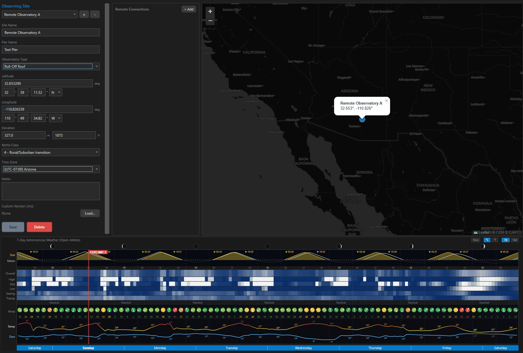
| Field | Notes |
|---|---|
| Name / Pier Name | the site name appears everywhere; Pier Name optionally identifies a specific mount when one location hosts several |
| Observatory Type | None/Open Air, Dome, Roll-Off Roof, Fixed Pier, Portable, Remote/Hosted – descriptive today, reserved for future condition logic |
| Latitude / Longitude | enter as decimal degrees or degrees/minutes/seconds with N/S and E/W pickers – the two stay in sync either way |
| Elevation | dual meters/feet inputs, synced |
| Bortle Class | 1 (excellent dark) through 9 (inner city) |
| Time Zone | grouped by UTC offset; drives local-time display and night boundaries |
| Notes | free text for your own records |
Custom Horizon (.hrz) #
Upload a horizon profile – a plain-text list of azimuth/altitude pairs describing your real skyline, in the same format NINA, Stellarium, and Astro-Physics use. Once loaded, Sky View draws the obstruction line over the stars and the scheduler refuses to plan imaging behind your trees or roofline. The full story lives in Custom Horizons; the upload and clear buttons live here on the site.
Weather & Map, Built In #
Because a site has real coordinates, its editor shows a live map marker and the site’s weather forecast panel – the same night-by-night cloud/seeing/transparency outlook described in Weather Forecasting. Add a second site (the dark-sky ranch, the club field) and each carries its own forecast, horizon, and time zone.
Remote Connections #
The Remote Connections sub-panel stores connection profiles for systems that live at this site – a NINA machine in the dome, a hosted rig, and similar. Each entry has a service type, name, a test/connect button, edit and delete actions, and a gold-star default marker for the site’s primary system.
Where Site Data Is Used #
- Latitude / longitude – twilight and darkness windows, target altitude and transit, moon position and separation, Sky View, the scheduler, and weather – essentially everything time-and-sky related.
- Bortle class – converted to an approximate SQM to seed sky brightness in the Exposure Calculator.
- Time zone – all local-time displays and the noon-to-noon night grouping.
- Custom horizon – Sky View overlay and hard scheduling constraint.
A site is also one third of every Imaging System. Edits propagate instantly to all projects on rigs at that site – and deletion is blocked while any project or imaging system still references it, so you cannot orphan your data.